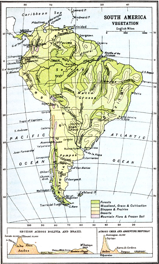
Description: A map from 1911 of South America showing the distribution of vegetation types. The map is color–coded to show regions of forests, regions of woodlands, grass, and cultivation, regions of steppes and prairies, desert regions, and regions of mountain flora and frozen soils. The map shows major river systems, and includes a chart at the bottom of the map with cross–sections across Bolivia and Brazil, and across Chile and the Argentine Republic.
Place Names: A Complete Map of South America, Andes, �Matto Grosse, �Brazil Mts, �Patagonia, �Pampa
ISO Topic Categories: biota
Keywords: Vegetation Distribution of South America, physical, �Vegetation, kBiodiversity, physical features, vegetation, biota, Unknown, 1911
Source: Ernest Rhys, Ed., A Literary and Historical Atlas of North & South America (New York, NY: E.P. Dutton & CO., 1911) 83
Map Credit: Courtesy the private collection of Roy Winkelman |
|