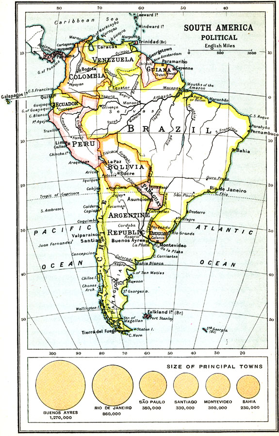
Description: A map from 1911 of South America showing the political boundaries of the time, major cities, rivers, and coastal features. A chart at the bottom of the map shows the relational population size of the principal South American cities of Buenos Ayres, Rio de Janeiro, São Paulo, Santiago, Montevideo, and Bahia, with populations of the time given.
Place Names: A Complete Map of South America, Argentina, �Bolivia, �Brazil, �Chile, �Columbia, �Guiana, �Ecuador, �Paraguay, �Peru, �Uruguay, �Venezuel
ISO Topic Categories: boundaries,
society
Keywords: Political South America, political, country borders, boundaries,
society, Unknown, 1911
Source: Ernest Rhys, Ed., A Literary and Historical Atlas of North & South America (New York, NY: E.P. Dutton & CO., 1911) 84
Map Credit: Courtesy the private collection of Roy Winkelman |
|