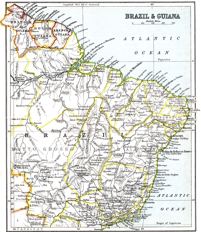
Description: A map from 1911 showing the British, Dutch, and French Guiana colonies, and eastern Brazil from approximately 60° west of Greenwich to the Atlantic Coast, and from Guiana in the north to São Paulo in the south, and the Amazon River from the Atlantic to Manaos. The map shows the Brazilian state boundaries at the time, major cities, towns, villages, ports, railways, rivers (including cataracts and intermittent rivers), terrain and coastal features.
Place Names: A Regional Map of South America, Brazil, �Guian
ISO Topic Categories: society,
boundaries
Keywords: Brazil and Guiana, political, �physical, physical features, country borders,
major political subdivisions, society,
boundaries, Unknown, 1911
Source: Ernest Rhys, Ed., A Literary and Historical Atlas of North & South America (New York, NY: E.P. Dutton & CO., 1911) 88
Map Credit: Courtesy the private collection of Roy Winkelman |
|