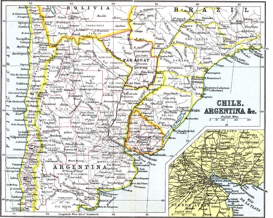
Description: A map from 1911 showing the political boundaries of Argentina, Chile, Paraguay, and Uruguay at the time. Bordering portions of Brazil and Bolivia are also shown. State boundaries are shown in red, and the map includes capitals, major cities, towns, ports, villages, railways, rivers, terrain and coastal features. An inset map details the mouth of the River Plate (Rio de La Plata) with the important cities of Buenos Ayres, Montevideo, and neighboring cities.
Place Names: A Regional Map of South America, Chile, �Argentina, �Paraguay, �Uragua
ISO Topic Categories: society
Keywords: Chile and Argentina, political, �physical, �transportation, physical features, country borders,
major political subdivisions, railroads, society, Unknown, 1911
Source: Ernest Rhys, Ed., A Literary and Historical Atlas of North & South America (New York, NY: E.P. Dutton & CO., 1911) 92
Map Credit: Courtesy the private collection of Roy Winkelman |
|