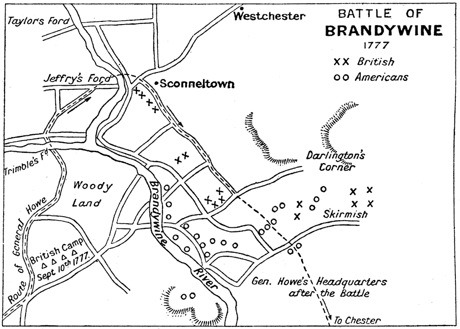
Description: A battle plan of the Battle of Brandywine in Pennsylvania south of Philadelphia during the American Revolution (September 11, 1777). The American defeat of this battle allowed the British to capture Philadelphia. The map shows the Brandywine River, the strategic crossings at Taylor's Ford, Trimble's Ford, and Jeffry's Ford, roads in the area, the British camp of September 10, the route of British commander Howe's flanking maneuver, the British and American positions, and the site of the skirmish near Darlington's Corner.
Place Names: Early America 1400-1800, Brandywine, �Pennsylvania, �American Revolutio
ISO Topic Categories:
Keywords: Battle of Brandywine, historical, kAmericanRevolution, kBattle, American Revolution, Unknown, 1777
Source: Ernest Rhys, Ed., A Literary and Historical Atlas of North & South America (New York, NY: E.P. Dutton & CO., 1911) 119
Map Credit: Courtesy the private collection of Roy Winkelman |
|