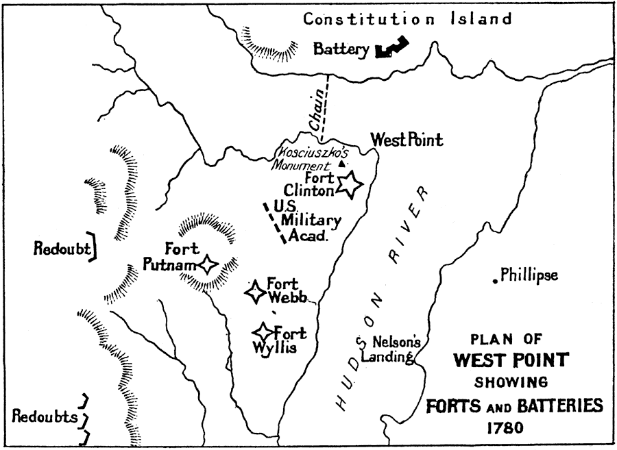
Description: A sketch map of the vicinity of West Point, New York, in 1780 showing forts Putnam, Wyllis, Webb, and Clinton (renamed from Fort Arnold after the treasonous act of Benedict Arnold in 1780), the ‘Great Chain’ across the Hudson River preventing the British from sailing upriver, the U.S. military academy, and the monument to Tadeusz Kosciuszko, the Polish engineer and Revolutionary War hero who oversaw the construction of the garrison defenses.
Place Names: Early America 1400-1800, New York, �West Point, �American Revolutio
ISO Topic Categories:
Keywords: Plan of West Point showing Forts and Batteries, historical, kAmericanRevolution, This is a battle plan of notable battles and districts connected with famous authors and their books: This is a map of the American Revolutionary Battle of Freeman's Farm. This battle was the first in the Saratoga campaign and is sometimes known as 'First Saratoga'.American Revolution, Unknown, 1780
Source: Ernest Rhys, Ed., A Literary and Historical Atlas of North & South America (New York, NY: E.P. Dutton & CO., 1911) 120
Map Credit: Courtesy the private collection of Roy Winkelman |
|