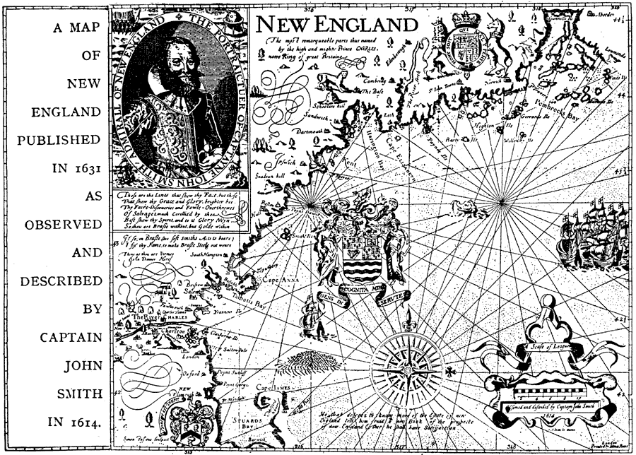
Description: A facsimile of an early map of New England in 1631 as observed by Captain John Smith in 1614. The map covers the coastline from Cape James (Cape Cod) and Stuards Bay (Cape Cod Bay) north to Pembrocks Bay and the Bay of Fundy. A settlement is shown at the Bayer Charles and Mt. Charleston.
Place Names: Early America 1400-1800, New Englan
ISO Topic Categories: society
Keywords: New England, historical, �transportation, kEarlyMapsFacsimile, water routes, society, Unknown, 1631
Source: Ernest Rhys, Ed., A Literary and Historical Atlas of North & South America (New York, NY: E.P. Dutton & CO., 1911) 124
Map Credit: Courtesy the private collection of Roy Winkelman |
|