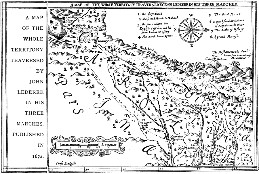
Description: A facsimile of an early map (1672) showing the three routes taken by explorer John Lederer from the headwaters of the York River inland to the Appalachian Mountains between 1669 and 1670. The map is oriented with north to the right, and shows the territories of Virginia and Carolinas as they were then known. It was believed at the time that the riches of California lay just beyond the mountains of West Virginia, and Lederer was commissioned to find a route to the area. The map is keyed to show his findings, including rivers, marshes, native villages, and the mountains of the Blue Ridge.
Place Names: Early America 1400-1800, Virgina, �Carolina, �Colonial Americ
ISO Topic Categories: society
Keywords: Sir John Lederer's Marches, historical, �physical, kEarlyMapsFacsimile, physical features,
topographical, society, Unknown, 1672
Source: Ernest Rhys, Ed., A Literary and Historical Atlas of North & South America (New York, NY: E.P. Dutton & CO., 1911) 125
Map Credit: Courtesy the private collection of Roy Winkelman |
|