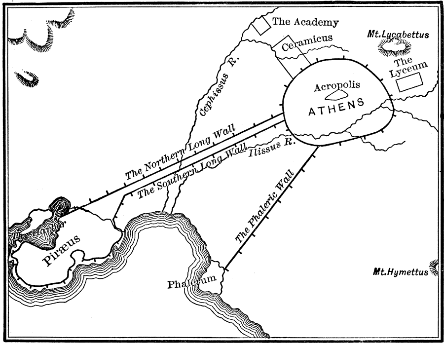
Description: Map of Athens and the walls surrounding it. Shows the location of the Academy, Ceramicus, the Lyceum, and Acropolis. The three long walls shown are the Northern Long Wall, the Southern Long Wall, and the Phaleric Wall. "As a part of his maritime policy, Pericles persuaded the Athenians to build what were known as the Long Walls, — great ramparts between four and five miles in length, ‐ which united Athens to the ports of Piræus and Phalerum. Later, as a double security, a third wall was built parallel to the one running to the former harbor. By means of these walls Athens and her ports, with the intervening land, were converted into a vast fortified district, capable in time of war of holding the entire population of Attica. With her communication with the sea thus secured, and with a powerful navy at her command, Athens could bid defiance to her foes on se and land." —Myers, 1896
Place Names: Greece, Athen
ISO Topic Categories: location,
oceans,
society
Keywords: Athens and the Long Walls, physical, �walls, kAncientGreece, physical features,
topographical, location,
oceans,
society, Unknown, 459–431 BC
Source: P. V. N. Myers, A General History for Colleges and High Schools (Boston, MA: Ginn & Company, 1896) 142
Map Credit: Courtesy the private collection of Roy Winkelman |
|