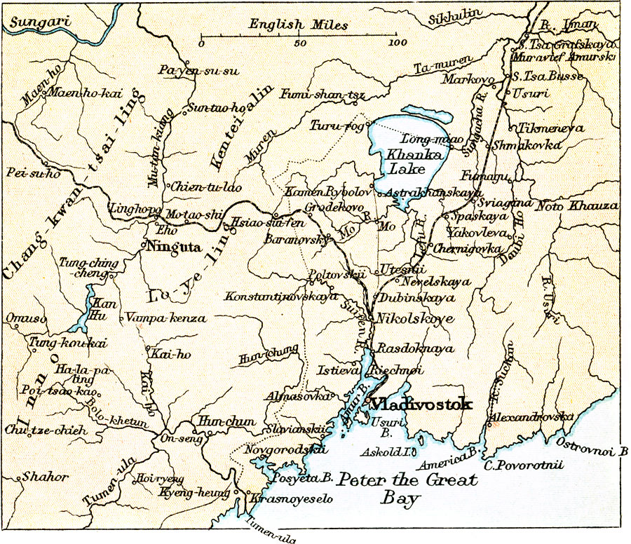
Description: A map from 1912 of the area around the Russian port of Vladivostok on the southern tip of the Muravyov–Amursky Peninsula, including the eastern portion of Outer Manchuria and Lake Khanka. The map shows the route of the Trans–Siberian Railway and the Trans–Manchurian Railway that converge at Nikolskoye to the north of Vladisvostok.
Place Names: Russia, Vladivosto
ISO Topic Categories: society,
transportation
Keywords: Far East Russia around Vladivostok, transportation, �physical, physical features, railroads, society,
transportation, Unknown, 1912
Source: Ernest Rhys, Ed., A Literary and Historical Atlas of Asia (New York, NY: E.P. Dutton & CO., 1912) 96
Map Credit: Courtesy the private collection of Roy Winkelman |
|