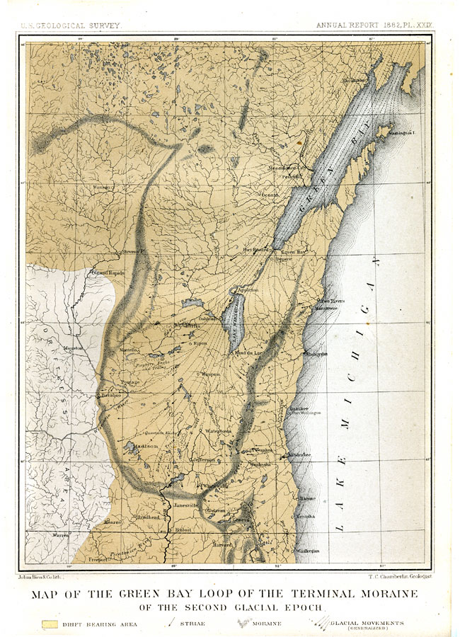
Description: A map from 1882 of Wisconsin showing moraine evidence from the Second Glacial Epoch. The map shows the moraine of the Green Bay glacier, including the drift bearing area, the generalized directions of glacial movement, the direction of glacial striae, and the locations of prominent terminal moraines, the Quartzite and Porphyry Knobs. Map referenced to Julius Bien and Co. lith. "The moraine of the Green Bay glacier parts from that of the Lake Michigan lobe near the northwestern corner of Walworth County, about 20 miles north of the southern limit of Wisconsin, and about 45 miles west of Lake Michigan. From this point a common intermediate moraine, formed jointly by the action of the Lake Michigan and Green Bay glaciers, extends northerly and northeasterly..." — Chamberlin, 1882.
Place Names: Wisconsin, Milwaukee, �Oshkosh, �Green Bay, �Sheboygan, �Madison, �Baraboo, �Wasau, �Lake Winnebago, �Lake Michiga
ISO Topic Categories: geoscientificInformation,
inlandWaters
Keywords: The Green Bay Loop of The Terminal Moraine , physical, �Quartzite Knobs, �Porphyry Knobs and Trails, �Driftless Area, kGlacial, physical features, geoscientificInformation,
inlandWaters, Unknown, 1882
Source: Thomas C. Chamberlin, United States Geological Survey Annual Report, 3rd (Washington, DC: United States Geological Survey, 1882) PL.XXIX
Map Credit: Courtesy the private collection of Roy Winkelman |
|