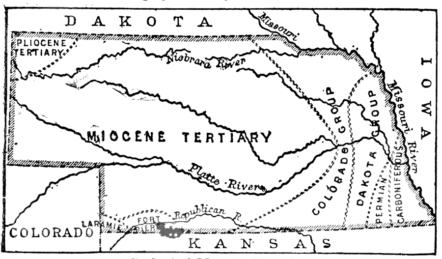
Description: A map from 1903 of Nebraska showing county borders, cities and towns, rivers, and railroads. This map also shows the rock types in the state. "Nebraska, a central State of the American Union, lies between 40° and 43° N. lat.; the Missouri flows along its eastern side, the most easterly point being 95° 25’ W long., and the boundary line separating it from Wyoming on the west is 104° W. long. It is bounded on the S. by Colorado and Kansas, on the E. by Missouri and Iowa, on the N. by Dakota, and on the W. by Wyoming and Colorado. The width of the State from north to south is 208.1/2; miles, the length from east to west 413 miles, and the area 76,647 square miles, or 49,054,080 acres." — Kellogg, 1903.
Place Names: Nebraska, Lincoln, �Omaha, �Platte Rive
ISO Topic Categories: boundaries,
transportation,
inlandWaters
Keywords: Nebraska, physical, �political, �transportation, physical features, major political subdivisions,
county borders, railroads, boundaries,
transportation,
inlandWaters, Unknown, 1903
Source: Day Otis Kellogg, Encyclopædia Britannica Vol. XVII (New York, NY: Werner Company, 1903) 306
Map Credit: Courtesy the private collection of Roy Winkelman |
|