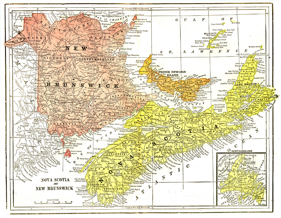
Description: A map from 1903 of the Canadian Maritime Provinces of New Brunswick, Nova Scotia, Prince Edward Island, and an inset of Newfoundland. The map shows province and county borders, rivers, cities, and railroads. "New Brunswick, a province of Canada, in British North America, lying between 45° 50’ and 68° W. long. It is bounded on the N.W. by Quebec; N. by the Bay of Chaleur; E. by the Gulf of St. Lawrence and Northumberland Strait, which separates it from Prince Edward Island; S. by a portion of Nova Scotia, Chignecto Bay, and the Bay of Fundy; and on the W. by the State of Maine. Its length from north to south is 230 miles, its greatest breadth 190 miles, and it has a seaboard of some 545 miles, interrupted only by the isthmus of Cignecto, which joins the province to Nova Scotia. In shape it is very compact, resembling an irregular quadrangle. Its area is 27,177 square miles." —Kellogg, 1903.
Place Names: Canada, New Brunswick, �Prince Edward Island, �Nova Scotia, �Newfoundland, �Bay of Fundy, �Northumberland Strait, �Gulf of St. Lawrence, �Atlantic Ocea
ISO Topic Categories: boundaries,
oceans,
inlandWaters,
transportation
Keywords: Nova Scotia, New Brunswick, Prince Edward Island, and Newfoundland, physical, �political, �transportation, physical features, country borders,
major political subdivisions,
county borders, railroads, boundaries,
oceans,
inlandWaters,
transportation, Unknown,1903
Source: Day Otis Kellogg, Encyclopædia Britannica Vol. XVII (New York, NY: Werner Company, 1903) 372
Map Credit: Courtesy the private collection of Roy Winkelman |
|