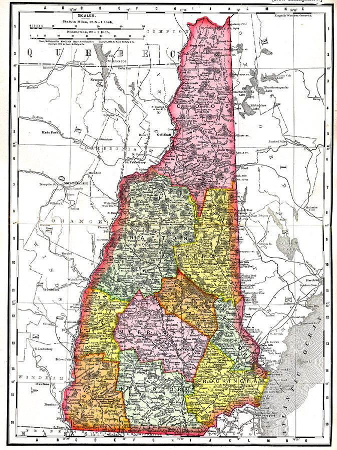
Description: A map from 1903 of New Hampshire showing the capital of Concord, counties and county seats, principal cities and towns, railroads, rivers, and mountain ranges. "New Hampshire, one of the New England States of the American Union, lies between 70° 37&rsquot; and 72° 37&rsquot; W. long., and between 42° 40&rsquot; and 45° 18&rsquot; 23" N. lat., and has an area of 9336 square miles. Its boundaries are partly natural. On the W. it is separated from the State of Vermont by Connecticut river; on the N. from the province of Quebec by the natural ridge of the watershed between the St. Lawrence and the streams flowing south to the Atlantic; on the E. from Maine by a straight line from Quebec to the source of the Salmon river, thence by this river to the ocean, and south–easterly through the middle of the Isles of Shoals; the boundary on the S.E. is the Atlantic; and that on the S. is a line 2 1/2; miles distant from and parallel to the lower Merrimack, until that river changes its course to due north and south, when the line runs magnetic west to Connecticut river. The general shape of the State is nearly that of a right-angled triangle, having the perpendicular 180 and the hypothenuse 190 miles long. The greatest width is 100 miles, from Chesterfield to the outermost of the Isles of Shoals." — Kellogg, 1903.
Place Names: New Hampshire, Concord, �Plymouth, �Colebrook, �Nashua, �Dover, �Lancaster, �Rochester, �Portsmout
ISO Topic Categories: boundaries,
inlandWaters,
transportation
Keywords: New Hampshire, physical, �political, physical features,
topographical, country borders,
major political subdivisions,
county borders, boundaries,
inlandWaters,
transportation, Unknown,1903
Source: Day Otis Kellogg, Encyclopædia Britannica Vol. XVII (New York, NY: Werner Company, 1903) 392
Map Credit: Courtesy the private collection of Roy Winkelman |
|