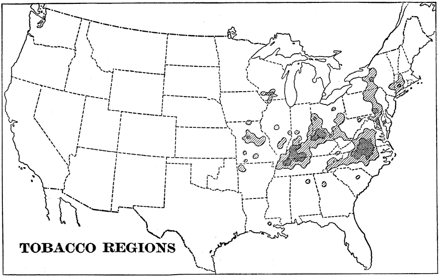
Description: A map of the United States showing the tobacco regions in the contiguous 48 states as of 1898, keyed to show areas of moderate cultivation and heavy cultivation. "As much tobacco is raised in the United States as in all the rest of the world together, and of this crop there is a large surplus for export. The chief tobacco growing regions are shaded on the map, three quarters of the crop being raised in the regions of darker shading." — Redway, 1898.
Place Names: Agriculture, tobacc
ISO Topic Categories: farming,
economy
Keywords: Tobacco Regions, statistical, �historical, kAgriculture, agriculture,
economic, farming,
economy, Unknown,1898
Source: Jacques W. Redway and Russell Hinman, Natural Advanced Geography (New York, NY: American Book Company , 1898) 58
Map Credit: Courtesy the private collection of Roy Winkelman |
|