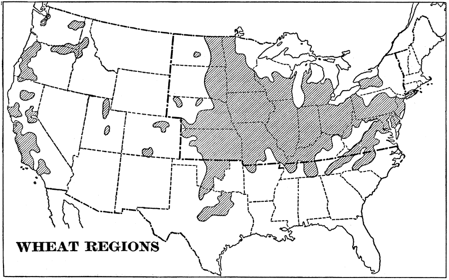
Description: A map from 1898 of the United States showing the principal wheat farming regions of the country at the time. "We export great quantities of this grain [wheat] every year. Wheat requires less heat and moisture than cotton. The shaded portions of the map show the great wheat–growing regions of the United States. Although the greater part of the wheat is grown in the northeastern quarter, much is also raised in the fertile valleys near the Pacific coast." — Redway, 1898.
Place Names: Agriculture, whea
ISO Topic Categories: farming,
economy
Keywords: Wheat Regions, statistical, �historical, kAgriculture, agriculture,
economic, farming,
economy, Unknown,1898
Source: Jacques W. Redway and Russell Hinman, Natural Advanced Geography (New York, NY: American Book Company , 1898) 58
Map Credit: Courtesy the private collection of Roy Winkelman |
|