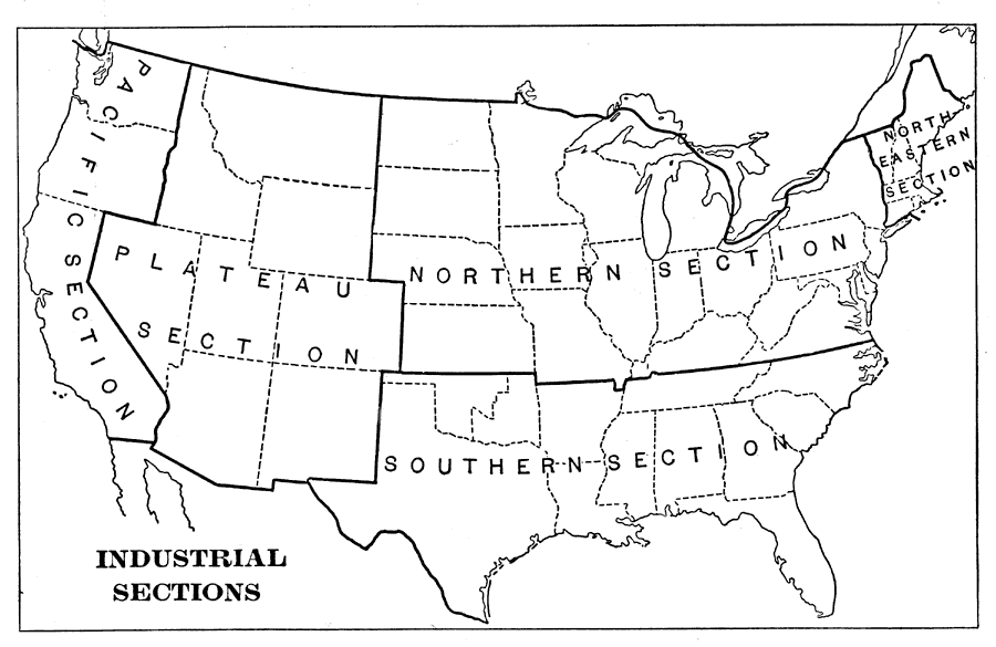
Description: A map from 1898 of the United States showing the Industrial Sections of the contiguous 48 states at the time. "Owing largely to differences in surface structure, climate, and soil, the great productions of our country are confined more or less definitely to different regions. Hence the United States may be naturally separated in to (1) the Northeastern, or cloth–manufacturing section; (2) the Northern, or food–,iron–, and coal–producing section; (3) the Southern, or cotton–producing section; (4) the Plateau, or grazing and gold– and silver–mining section; and (5) the Pacific, or Western food– and gold–producing section." &mdashRedway, 1898.
Place Names: Industry, textiles, �iron, �mining, �agriculture, �cotton, �gold, �coa
ISO Topic Categories: society
Keywords: Industrial Sections, statistical, �historical, kIndustry, industry, society, Unknown,1898
Source: Jacques W. Redway and Russell Hinman, Natural Advanced Geography (New York, NY: American Book Company , 1898) 61
Map Credit: Courtesy the private collection of Roy Winkelman |
|