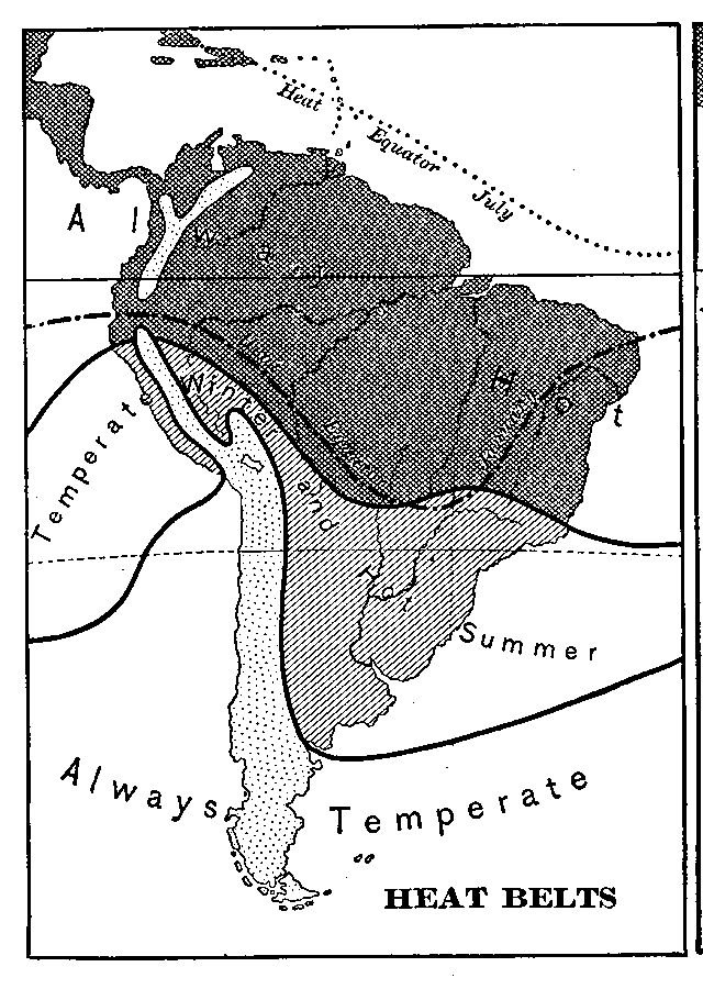
Description: A map from 1898 of the Heat Belts in South America showing the Heat Equator in July, regions where it is always hot, regions of temperate winters and hot summers, and regions where it is always temperate. "There is comparatively little difference between the temperatures of winter and summer in South America. Most of the lowlands are always hot; in the extreme south they are stormy, chilly, and disagreeable, but is seldom very cold; the elevated plateaus of the Andes are always temperate, and the higher summits of this chain always cold. It is only a comparatively narrow belt that there is a notable difference between the temperatures of summer and winter, and in this region the winters are seldom cold enough for the formation of ice. The most plainly marked seasons are the wet and dry, and they are determined by the position of the equatorial rain belt." — Redway and Hinman, 1898.
Place Names: A Complete Map of South America, heat belts, �heat equato
ISO Topic Categories: climatologyMeteorologyAtmosphere
Keywords: Heat Belts in South America, meteorological, �historical, kClimate, climate, climatologyMeteorologyAtmosphere, Unknown,1898
Source: Jacques W. Redway and Russell Hinman, Natural Advanced Geography (New York, NY: American Book Company , 1898) 104
Map Credit: Courtesy the private collection of Roy Winkelman |
|