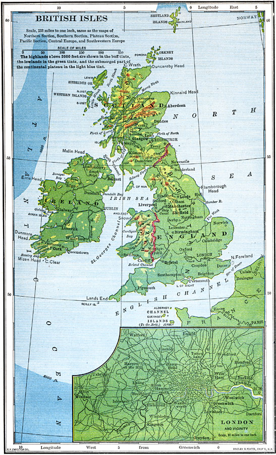
Description: A map of the British Isles from 1898. The map shows major cities, and is color-coded to show highlands above 2000 feet in buff tints, lowlands in green tints, and the submerged part of the continental plateau in light blue tint. The map includes an insert of London and vicinity. "Most of the land in the British Isles is owned by a comparatively few rich families of nobles, and but one fourth of it is under crops. A much larger proportion is used for pasturage, and cattle and sheep raising are important industries, Great Britain producing more mutton and wool than any other country in Europe except Russia. Grain, hay, vegetables, some fruits, and much dairy products and meat are produced, but only a small part of the people are engaged in agricultural and pastoral pursuits, and food of all kinds has to be imported in large quantities. More than half of the working population is engages in manufacturing, and a large part of the remainder in commerce and mining, all of these industries being active in England." — Redway, 1898.
Place Names: United Kingdom, Manchester, �London, �Dundee, �Londonderry, �Plymouth, �Bristol, �Edinborough, �Scotland, �England, �Ireland, �Atlantic Ocean, �English Channel, �North Se
ISO Topic Categories: transportation,
oceans,
inlandWaters,
elevation,
boundaries
Keywords: British Isles, physical, �political, �transportation, �historical, physical features,
topographical, country borders,
major political subdivisions, roads,
water routes, transportation,
oceans,
inlandWaters,
elevation,
boundaries, Unknown,1898
Source: Jacques W. Redway and Russell Hinman, Natural Advanced Geography (New York, NY: American Book Company , 1898) 122
Map Credit: Courtesy the private collection of Roy Winkelman |
|