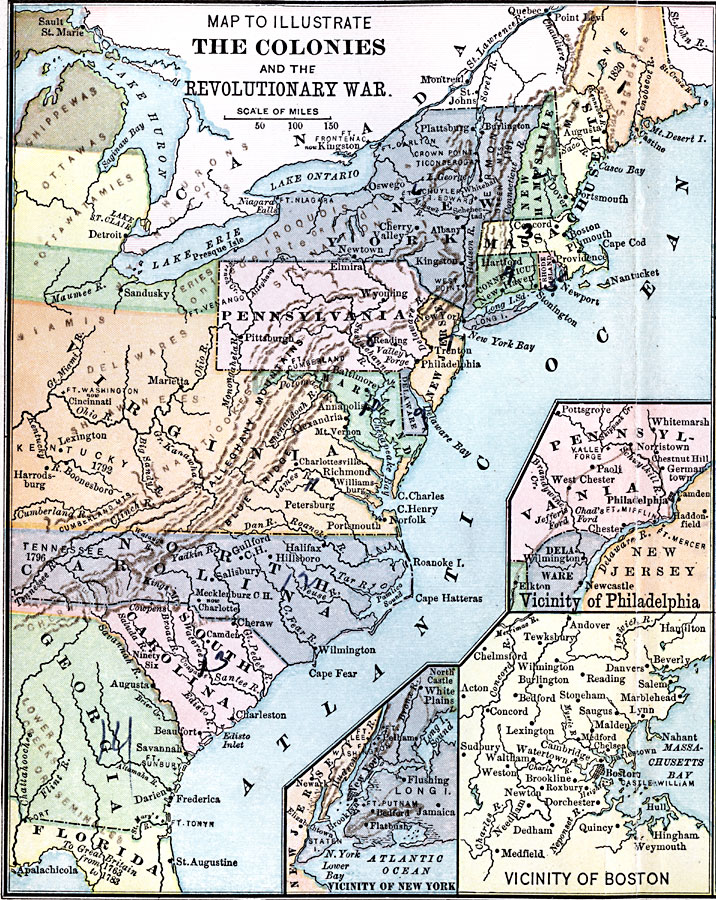
Description: A map of the Thirteen Colonies during the American Revolution. The map shows the territorial claims west of the Allegheny Mountains, and includes inset maps detailing the vicinity of Philadelphia, the vicinity of Boston, and the vicinity of New York. The map also shows the general areas of the Native Americans.
Place Names: Early America 1400-1800, Boston, �New York, �Albany, �Augusta, �Philadelphia, �American Revolution, �Colonial Americ
ISO Topic Categories: boundaries,
inlandWaters,
location,
oceans
Keywords: The Colonies during the Revolutionary War, physical, �political, �historical, kAmericanRevolution, kNativeAmerican, physical features, country borders,
major political subdivisions, American Revolution, boundaries,
inlandWaters,
location,
oceans, Unknown, 1775–1783
Source: Joel Dorman Steele, A Brief History of the United States (New York, NY: American Book Company, 1885) 101
Map Credit: Courtesy the private collection of Roy Winkelman |
|