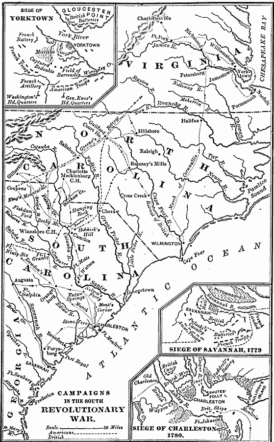
Description: A map of the portions of Virginia, North Carolina, South Carolina, and Georgia involved in major campaigns of the American Revolutionary War. The map shows cities, towns, and forts, rivers and terrain features, and is keyed to show British and American routes during the campaigns. Inset maps detail the Siege of Yorktown, the Siege of Savannah, and the Siege of Charleston.
Place Names: Early America 1400-1800, New York, �Philadelphia, �American Revolution, �Colonial Americ
ISO Topic Categories: boundaries,
inlandWaters,
location,
oceans,
intelligenceMilitary
Keywords: American Revolutionary War Campaigns in the South, physical, �political, �historical, kAmericanRevolution, physical features, country borders,
major political subdivisions,
local jurisdictions, American Revolution, boundaries,
inlandWaters,
location,
oceans,
intelligenceMilitary, Unknown, 1775–1783
Source: Joel Dorman Steele, A Brief History of the United States (New York, NY: American Book Company, 1885) 121
Map Credit: Courtesy the private collection of Roy Winkelman |
|