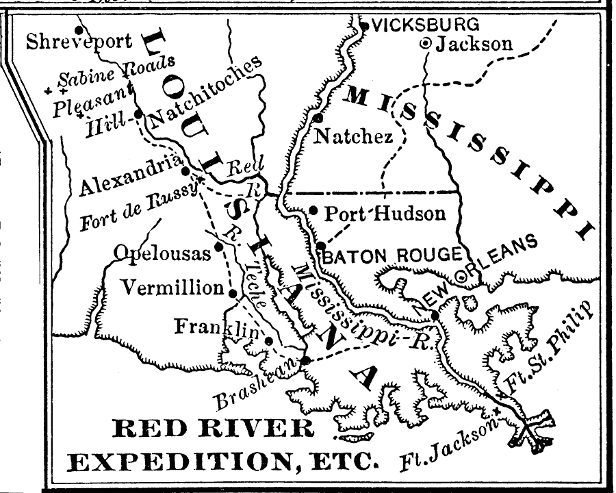
Description: A map of the Red River area of Louisiana, showing the operations during the Red River Campaign of 1864 during the American Civil War (March 10 to May 22). The map shows the route of General Banks from New Orleans west to Brashean (Brashear, now Morgan City) on Bayou Teche, Franklin (Battle of Irish Bend), Fort de Russy, Alexandria, Pleasant Hill, and Sabine Roads (Battle of Mansfield) near Shreveport.
Place Names: Civil War, New Orleans, �Port Hudson, �Baton rouge, �Vermillio
ISO Topic Categories: intelligenceMilitary,
inlandWaters,
location,
oceans,
boundaries
Keywords: Red River Expedition, physical, �historical, �political, physical features, major political subdivisions, Civil War, intelligenceMilitary,
inlandWaters,
location,
oceans,
boundaries, Unknown, 1864
Source: Joel Dorman Steele, A Brief History of the United States (New York, NY: American Book Company, 1885) 222
Map Credit: Courtesy the private collection of Roy Winkelman |
|