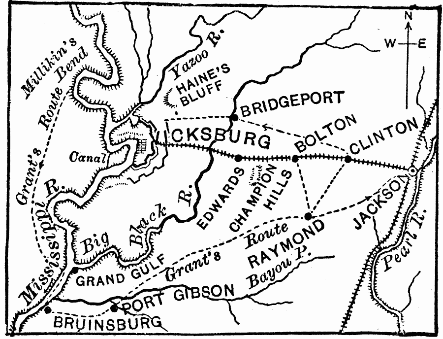
Description: The vicinity of Vicksburg, Mississippi during the American Civil War.The map shows the Mississippi River, strategic railroads, and Grant's advances through the area toward the seige and capture of Vicksburg.
Place Names: Civil War, Vicksburg, �Clinton, �Bolton, �Raymon
ISO Topic Categories: boundaries,
intelligenceMilitary,
inlandWaters,
location
Keywords: Vicinity of Vicksburg, physical, �political, �historical, �transportation, physical features, local jurisdictions, railroads, Civil War, boundaries,
intelligenceMilitary,
inlandWaters,
location, Unknown, May 15, 1863–July 4, 1863
Source: Joel Dorman Steele, A Brief History of the United States (New York, NY: American Book Company, 1885) 245
Map Credit: Courtesy the private collection of Roy Winkelman |
|