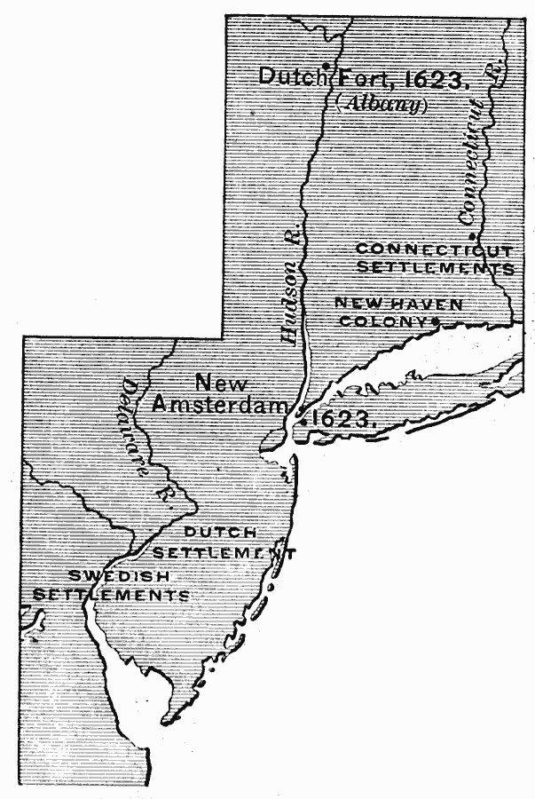
Description: A map of the Atlantic coast area from the Delaware Bay to the Connecticut River showing the territory claimed by the Dutch as New Netherlands (1614–1664), the territory around the Delaware Bay and Delaware River claimed by Sweden as New Sweden (1638–1655), and the western portion of the Connecticut settlements with the disputed territory of the Dutch and English over the area between the Hudson River and the Connecticut River. The map shows the Dutch Fort (Albany) on the Hudson River and New Amsterdam (New York) on Manhattan Island, both established in 1623, and the New Haven Colony established by the English Pilgrims in 1638.
Place Names: Early America 1400-1800, New Amsterdam, �Albany, �New Haven, �Colonial Americ
ISO Topic Categories: inlandWaters,
location,
oceans
Keywords: New Netherlands, New Sweden, and New England, physical, physical features, inlandWaters,
location,
oceans, Unknown, 1614–1664
Source: Edward Eggleston, The Household History of the United States and Its People (New York, NY: D. Appleton and Company, 1898) 50
Map Credit: Courtesy the private collection of Roy Winkelman |
|