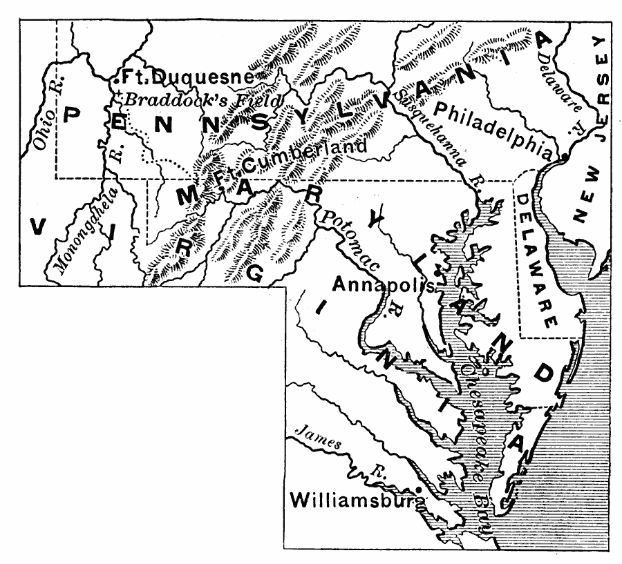
Description: A map showing British General Braddock's March in 1755 from Fort Cumberland on the Potomac, toward Fort Duquesne (now Pittsburgh) where the Allegheny and Monongahela rivers join to form the Ohio River. At the time of the French and Indian War, Fort Duquesne was a strategic point, held by the French, for controlling the Ohio Country west of the Allegheny Mountains.
Place Names: Early America 1400-1800, Pennsylvania, �Virginia, �Maryland, �Delaware, �New Jersey, �Annapolis, �Williamsburg, �Cumberland, �Colonial America, �English, �French, �Native Americans, �French Indian War
ISO Topic Categories: boundaries,
intelligenceMilitary,
inlandWaters,
location,
oceans
Keywords: Braddock's March, physical, �political, physical features, country borders, boundaries,
intelligenceMilitary,
inlandWaters,
location,
oceans, Unknown, 1755
Source: Edward Eggleston, The Household History of the United States and Its People (New York, NY: D. Appleton and Company, 1898) 131
Map Credit: Courtesy the private collection of Roy Winkelman |
|