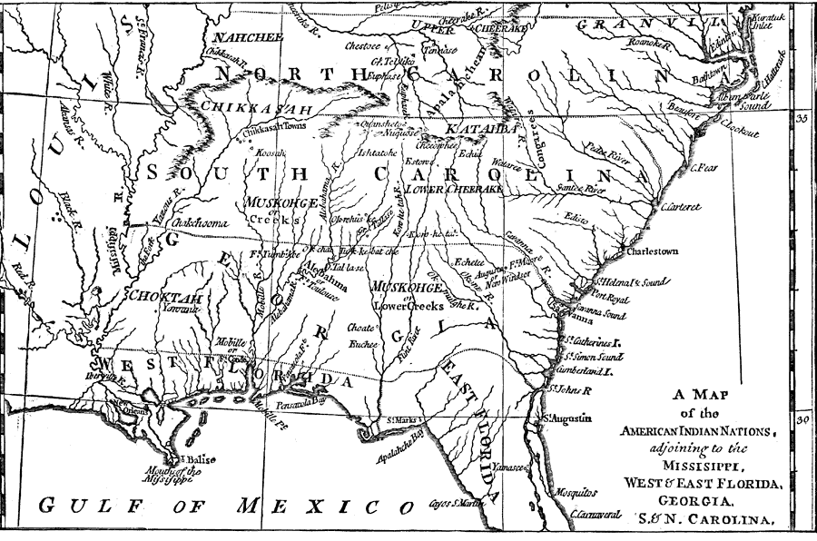
Description: An early map of the southeastern North America around 1776, showing the American Indian Nations of the region at the time. The map shows colonial boundaries extending from the Atlantic coast to the Mississippi River, towns, forts, and rivers.
Place Names: Early America 1400-1800, Florida, �East Florida, �West Florida, �Georgia, �South Carolina, �North Carolina, �Louisiana, �New Orleans, �Charlestown, �Charleston, �Mississippi River, ���Native American
ISO Topic Categories: boundaries,
inlandWaters,
society
Keywords: The American Indian Nations, physical, �historical, �Native American tribes, �American Indian nations, kNativeAmerican, physical features, country borders,
major political subdivisions, boundaries,
inlandWaters,
society, Unknown,1776
Source: Justin Winsor, Narrative and Critical History of North America Vol. VII (Boston, MA: Houghton, Mifflin and Company, 1888) 448
Map Credit: Courtesy the private collection of Roy Winkelman |
|