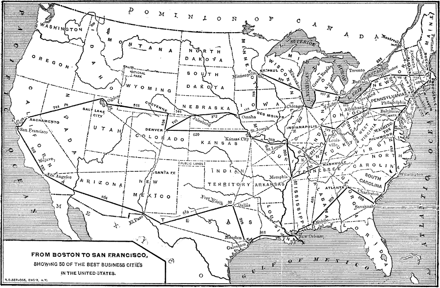
Description: From Boston to San Francisco, showing 50 of the best business cities in the United States.—Reference Book (and Key) Containing Ratings of Merchants, Manufacturers and Traders Generally, throughout the United States & Canada, 1902
Place Names: Transportation, Washington, �Richmond, �Albany, �Boston, �Portland, �Philadelphia, �Baltimore, �New York, �Jersey City, �Savannah, �Mobile, �Houston, �Galveston, �Kansas City, �St. Louis, �Nashville, �Atlanta, �Columbus, �Alleghany, �Cleveland, �Buffalo, �Detroit, �In
ISO Topic Categories: boundaries,
economy,
inlandWaters,
location,
oceans,
transportation
Keywords: Long Distance Routes between Boston and San Francisco, physical, �political, �statistical, �transportation, kTransportation, physical features, country borders,
major political subdivisions, economic, railroads, boundaries,
economy,
inlandWaters,
location,
oceans,
transportation, Unknown,1902
Source: , Reference Book (and Key) Containing Ratings of Merchants, Manufacturers and Traders Generally, throughout the United States & Canada (New York, NY: R.G. Dun & Co., 1902)
Map Credit: Courtesy the private collection of Roy Winkelman |
|