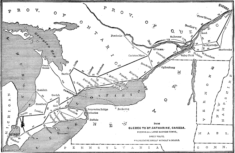
Description: A map from 1902 showing the principal commercial routes from Quebec to St. Catharine on the Niagara River showing all large business towns along the route with mileages between towns. The map also shows secondary, alternate, or distribution points to the other large business cities and towns in the region, including Pembroke on the Ottawa River, Owen Sound on Georgian Bay, Goderich on Lake Huron, Windsor on the Detroit River, and Buffalo and Rochester in New York.
Place Names: Canada, Detroit, �Windsor, �Chatham, �Sarnia, �London, �Ingersoll, �Woodstock, �Brantford, �Hamilton, �Toronto, �Guelph, �Goderich, �Lindsay, �Pertersboro, �Trenton, �Kingston, �Brockville, �Pembroke, �Ottawa, �Ogdensburg, �Montreal, �St. Johns, �St. Hyacinth
ISO Topic Categories: boundaries,
economy,
inlandWaters,
location,
oceans,
transportation
Keywords: Long Distance Routes between St. Catharine and Quebec, physical, �political, �statistical, �transportation, kEconomic, physical features, country borders,
major political subdivisions, economic, railroads, boundaries,
economy,
inlandWaters,
location,
oceans,
transportation, Unknown,1902
Source: , Reference Book (and Key) Containing Ratings of Merchants, Manufacturers and Traders Generally, throughout the United States & Canada (New York, NY: R.G. Dun & Co., 1902)
Map Credit: Courtesy the private collection of Roy Winkelman |
|