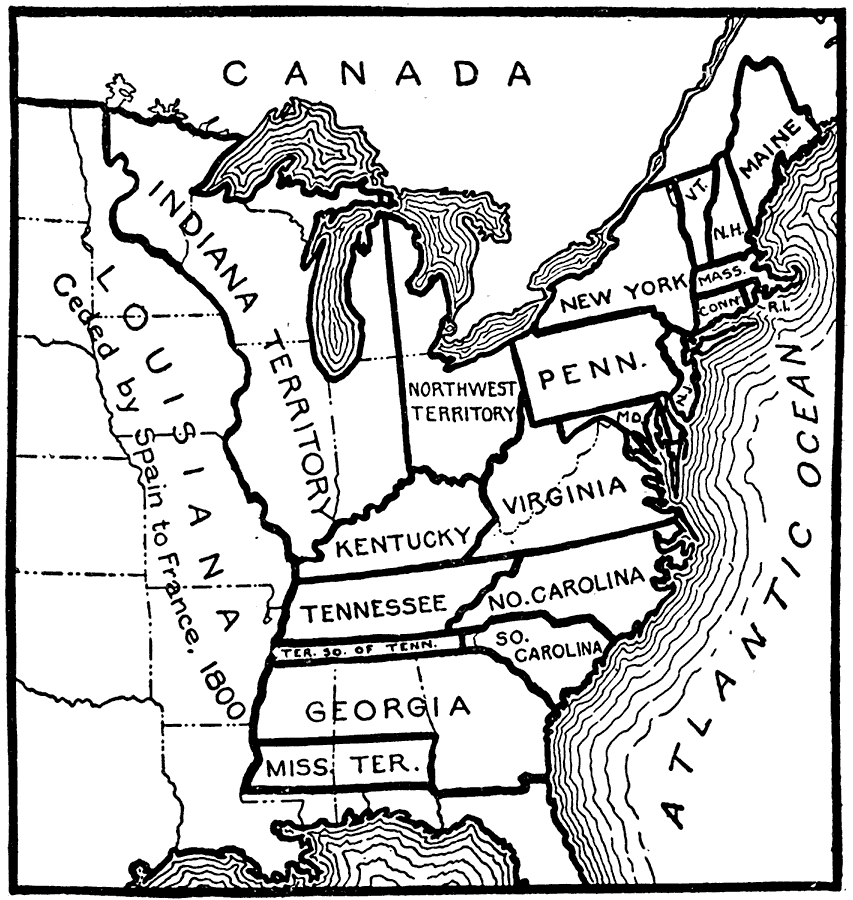
Description: A map of the United States in 1800 prior to the Louisiana Purchase. The map shows the State and Territory boundaries, and Louisiana ceded by Spain to France in 1800. "The first new state admitted was Vermont, in 1791, and the last were New Mexico and Arizona, which came into the Union in 1912. At the organization of the government, the Mississippi River formed the western boundary of the United States, and the area of the country was 828,000 square miles." — Foster, 1921.
Place Names: Early America 1400-1800, Maine, �Vermont, �New Hampshire, �Massachusetts, �Connecticut, �Rhode Island, �New York, �Pennsylvania, �New Jersey, �Maryland, �Virginia, �Kentucky, �Tennessee,�Territory South of Tennesse, �North Carolina, �South Carolina, �Georgia, �Mississippi Ter
ISO Topic Categories: boundaries
Keywords: United States, states,�boundaries, �river�physical, �political, physical features, country borders,
major political subdivisions, boundaries, Unknown,1800
Source: Ellsworth D. Foster, ed., The American Educator Vol. 8 (Chicago, IL: Ralph Durham Company, 1921) 3697
Map Credit: Courtesy the private collection of Roy Winkelman |
|