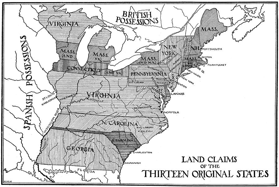
Description: A map of eastern North America showing the land claims of the original thirteen states after the American Revolutionary War, from the Atlantic coast to the Mississippi River, as well as the boundaries of the British and Spanish possessions. State boundaries, including multiple state claims, major cities and settlements, and rivers are shown.
Place Names: Early America 1400-1800, Boston, �New York, �British Possessions, �Spanish Possessions, �Raleigh, �Pittsburg, �Charleston, �Savannah, �Mississippi, �Lake Superior, �Lake Erie, �Lake Huron, �Lake Ontario, �Lake Michigan, �Springfield, �Portsmouth, �Vermont claimed by New Hampsh
ISO Topic Categories: boundaries
Keywords: Land Claims of the Thirteen Original States, political, �land, �claims, �boundariescountry borders,
major political subdivisions, boundaries, Unknown,1783
Source: Ellsworth D. Foster, ed., The American Educator Vol. 8 (Chicago, IL: Ralph Durham Company, 1921) 3703
Map Credit: Courtesy the private collection of Roy Winkelman |
|