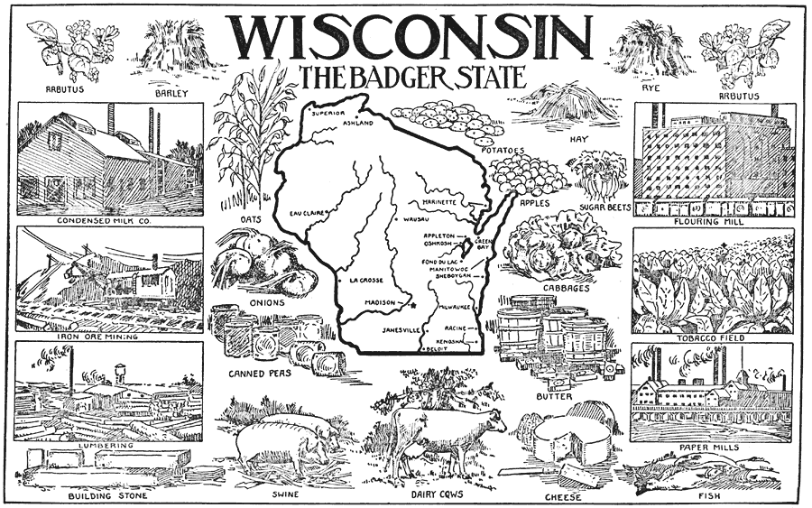
Description: Wisconsin, showing its capital Madison and other major cities and inland waters. It also has pictorial representations of the state's main industries, some of which are arbutus, rye, barley, condensed milk, iron ore mining, lumbering, flouring mill, tobacco, cheese, fish and butter. (circa 1921)
Place Names: Wisconsin, Ashland, �Superior, �Beloit, �La Crosse, �Madison, �Milwaukee, �Racine, �Appleton, �Oshkosh, �Wausau, �Eau Claire, �Marinette, �Greenbay, �Fond Du Lac, �Manitowoc, �Janesville, �Kenosha, �Sheboygan, �Lake Winnebago, �Wisconsin Riv
ISO Topic Categories: boundaries,
economy,
inlandWaters
Keywords: Wisconsin, the Badger State, physical, �political, physical features, major political subdivisions, boundaries,
economy,
inlandWaters, Unknown,1921
Source: Ellsworth D. Foster, ed., The American Educator Vol. 8 (Chicago, IL: Ralph Durham Company, 1921) 3901
Map Credit: Courtesy the private collection of Roy Winkelman |
|