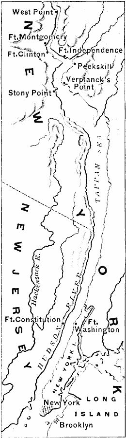
Description: A map of the Hudson River area from West Point to the Long Island Sound showing the Revolutionary War posts along the river, including West Point, Peekskill, Verplanck's Point, Stony Point, New York, Brooklyn, and the forts Montgomery, Clinton, Independence, Constitution, and Washington.
Place Names: Early America 1400-1800, New York, �Brooklyn, �American Revolution, �Colonial America, �Englis
ISO Topic Categories: intelligenceMilitary,
inlandWaters,
location
Keywords: The Hudson, physical, �historical, �political, kAmericanRevolution, physical features, local jurisdictions,
country borders, American Revolution, intelligenceMilitary,
inlandWaters,
location, Unknown, 1776–1783
Source: Edward Eggleston, The Household History of the United States and Its People (New York, NY: D. Appleton and Company, 1898) 187
Map Credit: Courtesy the private collection of Roy Winkelman |
|