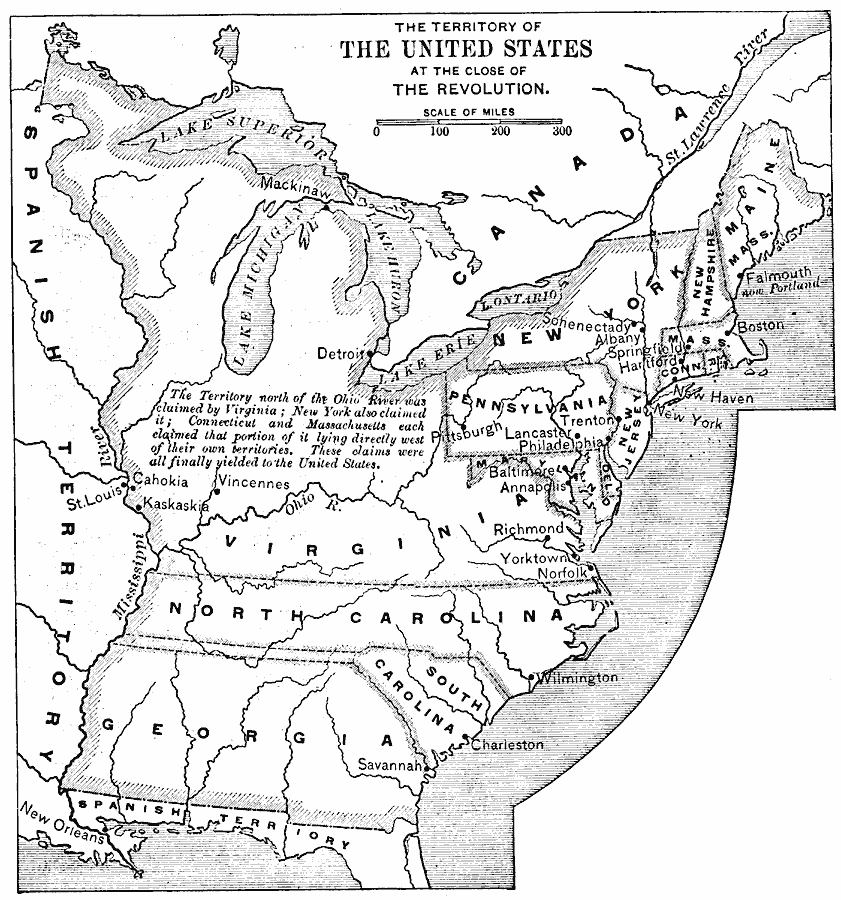
Description: A map of the United States at the close of the American Revolutionary War (1783) showing the newly formed States, and their claims to the lands west of the Allegheny Mountains to the Mississippi River. The map notes that the territory north of the Ohio River was claimed by Virginia, New York, Connecticut, and Massachusetts.
Place Names: Early America 1400-1800, Washington D.C., �New York, �Boston, �American Revolution, �Colonial Americ
ISO Topic Categories: boundaries,
inlandWaters,
oceans,
location
Keywords: The United States at the Close of the Revolution, physical, �political, �historical, physical features, major political subdivisions,
country borders, American Revolution, boundaries,
inlandWaters,
oceans,
location, Unknown, 1783
Source: Edward Eggleston, The Household History of the United States and Its People (New York, NY: D. Appleton and Company, 1898) 203
Map Credit: Courtesy the private collection of Roy Winkelman |
|