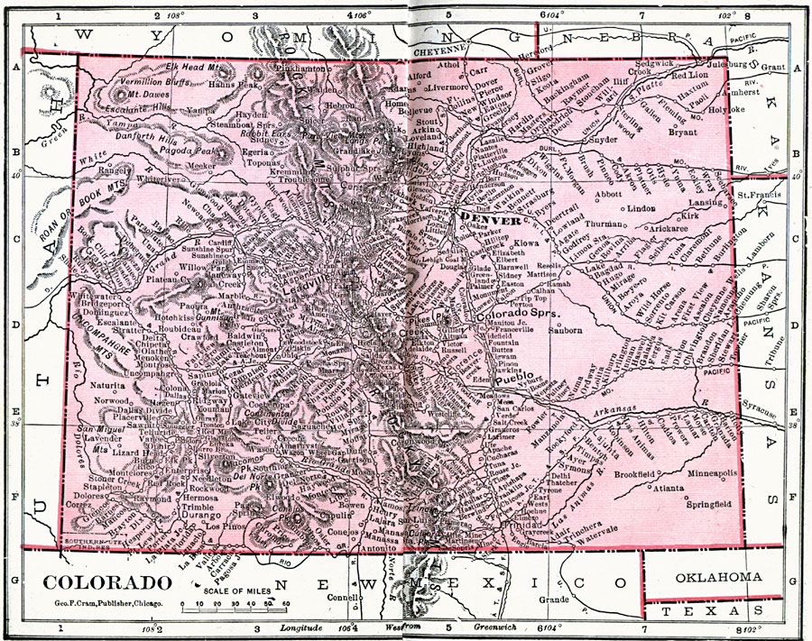
Description: A map from 1906 of Colorado showing the State capital of Denver, major cities and towns, railroads, the Rockies and other mountain systems, lakes, and rivers.
Place Names: Colorado, Central City, �Colfax, �Colorado Springs, �Denver, �Ft. Lyon, �Georgetown, �Greeley, �Kit Carson, �Leadville, �Puebl
ISO Topic Categories: boundaries,
inlandWaters,
location,
oceans
Keywords: Colorado, physical, �political, �borders, �boundaries, �physical features, country borders, boundaries,
inlandWaters,
location,
oceans, Unknown, 1906
Source: George F. Cram , Cram's Quick Reference Atlas and Gazetteer of the World (Chicago , IL: George F. Cram Series of Atlases, 1906) 46
Map Credit: Courtesy the private collection of Roy Winkelman |
|