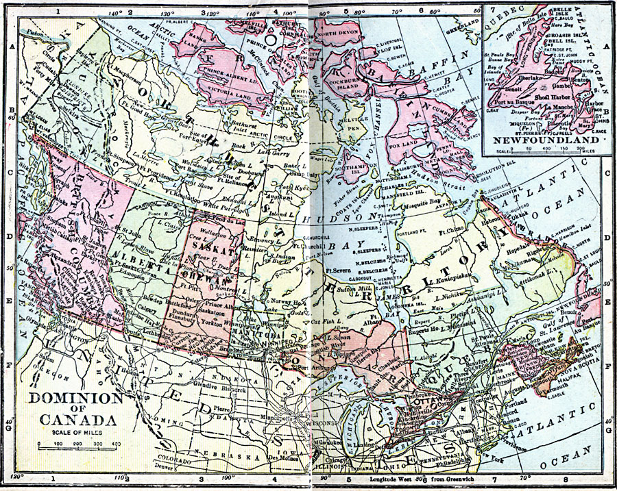
Description: A map from 1906 of the Dominion of Canada, showing the provinces and territories at the time, including Newfoundland and Labrador, Baffin Land, and Franklin. The map shows major cities, towns, settlements, forts, and ports, railroads, mountain systems, lakes, rivers, and coastal features.
Place Names: Canada, Calgary, �Churchill, �Edmonton, �Montreal, �Ottawa, �Quebec, �Toronto, �Vancouver, �Victoria, �Winnipe
ISO Topic Categories: boundaries,
inlandWaters,
location,
oceans
Keywords: The Dominion of Canada, physical, �political, �borders, �boundaries, �physical features, country borders, boundaries,
inlandWaters,
location,
oceans, Unknown, 1906
Source: George F. Cram , Cram's Quick Reference Atlas and Gazetteer of the World (Chicago , IL: George F. Cram Series of Atlases, 1906) 58
Map Credit: Courtesy the private collection of Roy Winkelman |
|