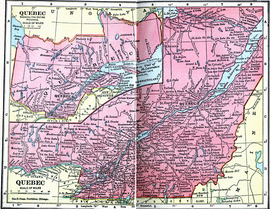
Description: A map from 1906 of the province of Quebec. The main map details the more populous region around the St. Lawrence River from Montreal to Quebec and north to the confluence of the Saguenay River and Tadousac. The map shows major cities and towns, railways, lakes and rivers. An inset map shows the entire province at a smaller scale to include the northern boundary and Gulf of St. Lawrence.
Place Names: Canada, Quebe
ISO Topic Categories: boundaries,
inlandWaters,
location,
oceans
Keywords: Quebec, physical, �political, �borders, �boundaries, �physical features, country borders, boundaries,
inlandWaters,
location,
oceans, Unknown, 1906
Source: George F. Cram , Cram's Quick Reference Atlas and Gazetteer of the World (Chicago , IL: George F. Cram Series of Atlases, 1906) 60
Map Credit: Courtesy the private collection of Roy Winkelman |
|