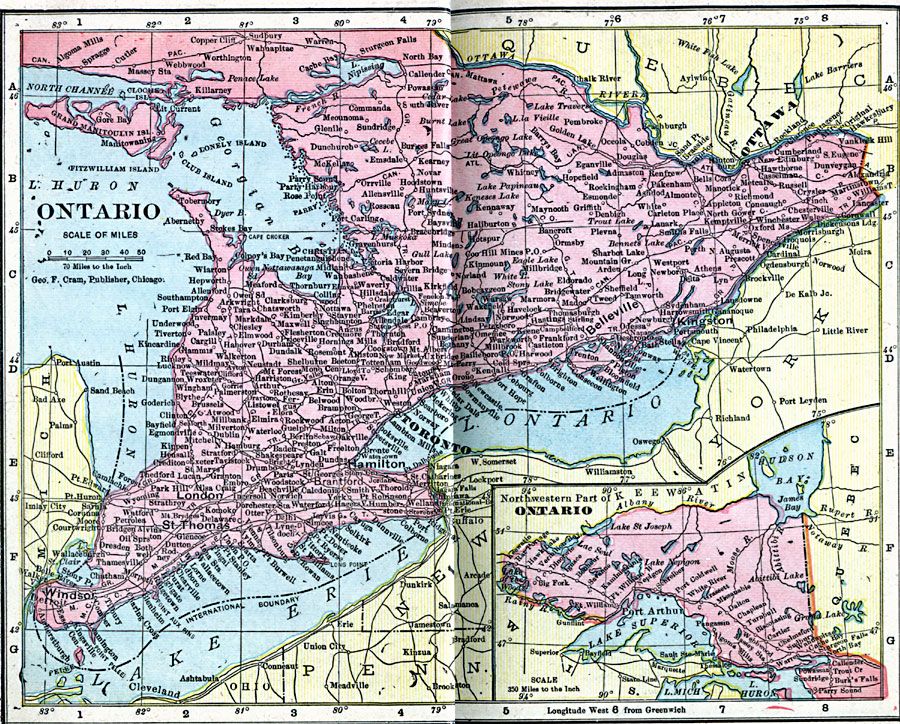
Description: A map from 1906 of the province of Ontario with an inset map of the northwestern part of the province. The map shows the Canadian capital of Ottawa and province capital of Toronto, major cities and towns, railways, lakes and rivers.
Place Names: Canada, Ontari
ISO Topic Categories: boundaries,
inlandWaters,
location,
oceans
Keywords: Ontario, physical, �political, �borders, �boundaries, �physical features, country borders, boundaries,
inlandWaters,
location,
oceans, Unknown, 1906
Source: George F. Cram , Cram's Quick Reference Atlas and Gazetteer of the World (Chicago , IL: George F. Cram Series of Atlases, 1906) 61
Map Credit: Courtesy the private collection of Roy Winkelman |
|