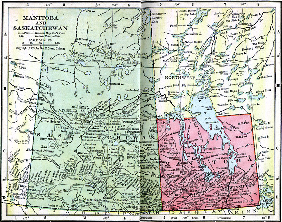
Description: A map from 1906 of the provinces of Manitoba and Saskatchewan showing the province capitals of Winnipeg and Regina, major cities and towns, existing and proposed railways, lakes and rivers, Hudson Bay Company posts, and Indian Reservations in the area.
Place Names: Canada, Manitoba, �Saskatchewa
ISO Topic Categories: boundaries,
inlandWaters,
location,
oceans
Keywords: Manitoba and Saskatchewan, physical, �political, �borders, �boundaries, kNativeAmerican, physical features, country borders, boundaries,
inlandWaters,
location,
oceans, Unknown, 1906
Source: George F. Cram , Cram's Quick Reference Atlas and Gazetteer of the World (Chicago , IL: George F. Cram Series of Atlases, 1906) 62
Map Credit: Courtesy the private collection of Roy Winkelman |
|