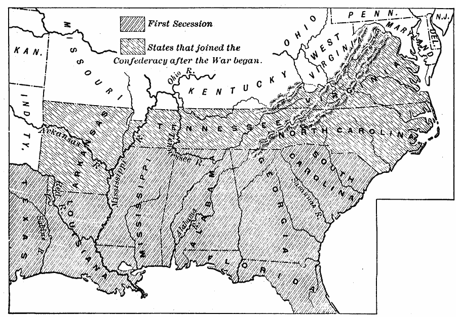
Description: A map of the Southern States during Secession, showing the states which first seceded (before April 15, 1861), and those which followed after the outbreak of the American Civil War.
Place Names: Civil War, Confederate territor
ISO Topic Categories: boundaries,
inlandWaters,
location,
oceans
Keywords: Secession of the South, physical, �political, physical features, major political subdivisions, Civil War, boundaries,
inlandWaters,
location,
oceans, Unknown, 1861
Source: Edward Eggleston, The Household History of the United States and Its People (New York, NY: D. Appleton and Company, 1898) 310
Map Credit: Courtesy the private collection of Roy Winkelman |
|