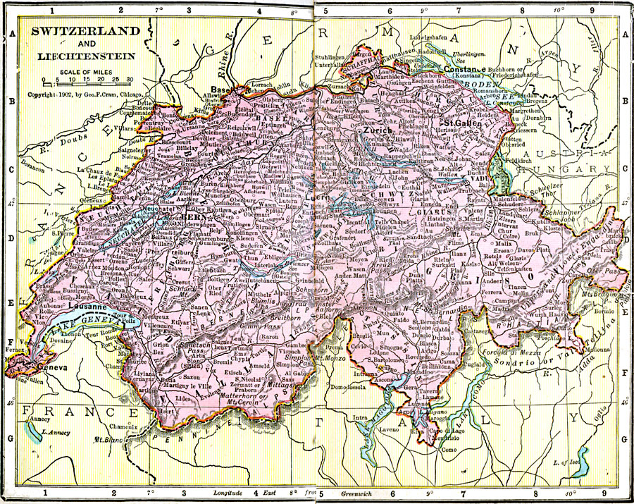
Description: Map of Switzerland and Lechtenstein in 1906 showing the cantons (states) of Switzerland and their capitals, major cities and towns, railways, rivers, lakes, and mountain systems. The map also shows the capital cities of Bern (Switzerland) and Vaduz (Liechtenstein).
Place Names: Switzerland, Lechtenstein, �Switzerlan
ISO Topic Categories: boundaries,
inlandWaters,
location,
oceans
Keywords: Switzerland and Liechtenstein, physical, �political, �borders, �boundaries, �physical features, country borders, boundaries,
inlandWaters,
location,
oceans, Unknown, 1906
Source: George F. Cram , Cram's Quick Reference Atlas and Gazetteer of the World (Chicago , Illinois : George F. Cram Series of Atlases, 1906) 81
Map Credit: Courtesy the private collection of Roy Winkelman |
|