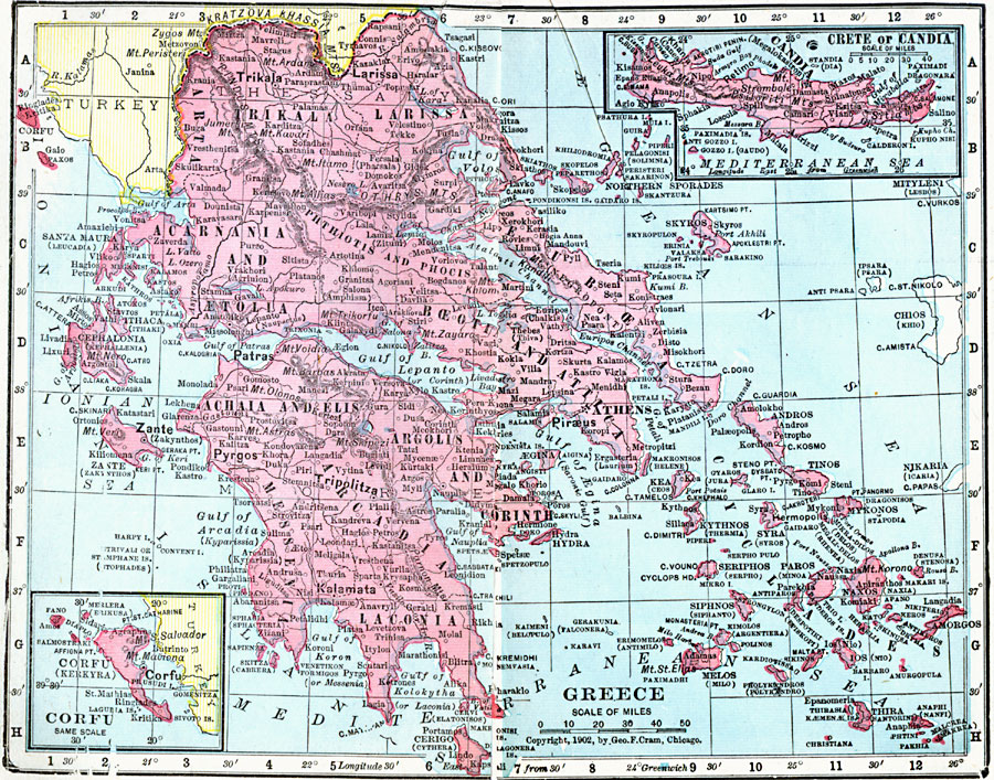
Description: A map of Greece in 1906, showing its frontier with Turkey following the Greco–Turkish War (1897) at the north of the peninsula along the Kratzova–Khassia Mountains (Thessaly), the Greek administrative divisions, major cities, towns, and ports, with an inset map of Corfu (Kerkyra) and an inset map of Crete or Candia.
Place Names: Greece, Alexandroupolis, �Athens, �Chalkis, �Elefsis, �Irakleion, �Kavala, �Kerkyra, �Patrai, �Thessaloniki, �Volo
ISO Topic Categories: boundaries,
inlandWaters,
location,
oceans
Keywords: Greece, physical, �political, �borders, �boundaries, �physical features, country borders, boundaries,
inlandWaters,
location,
oceans, Unknown, 1906
Source: George F. Cram , Cram's Quick Reference Atlas and Gazetteer of the World (Chicago , Illinois : George F. Cram Series of Atlases, 1906) 87
Map Credit: Courtesy the private collection of Roy Winkelman |
|