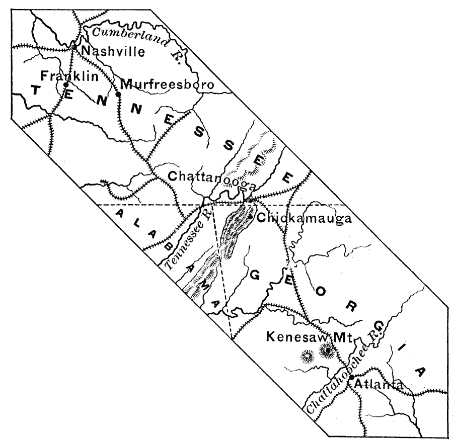
Description: A map of the parts of Tennessee, Alabama, and Georgia showing the main locations of the campaign between Nashville and Atlanta during the American Civil War (1863–1864). The map shows the cities and towns of Nashville, Franklin, Murfreesboro, Chattanooga, Chickamauga, and Atlanta, the battle site of Kenesaw (Kennesaw) Mountain, railroads, terrain features, and rivers in the area.
Place Names: Civil War, Nashville, �Franklin, �Chattanooga, �Atlant
ISO Topic Categories: boundaries,
intelligenceMilitary,
inlandWaters,
location,
oceans
Keywords: Campaign Between Nashville and Atlanta, physical, �political, �historical, �transportation, physical features, major political subdivisions, railroads, Civil War, boundaries,
intelligenceMilitary,
inlandWaters,
location,
oceans, Unknown, 1863–1864
Source: Edward Eggleston, The Household History of the United States and Its People (New York, NY: D. Appleton and Company, 1898) 334
Map Credit: Courtesy the private collection of Roy Winkelman |
|