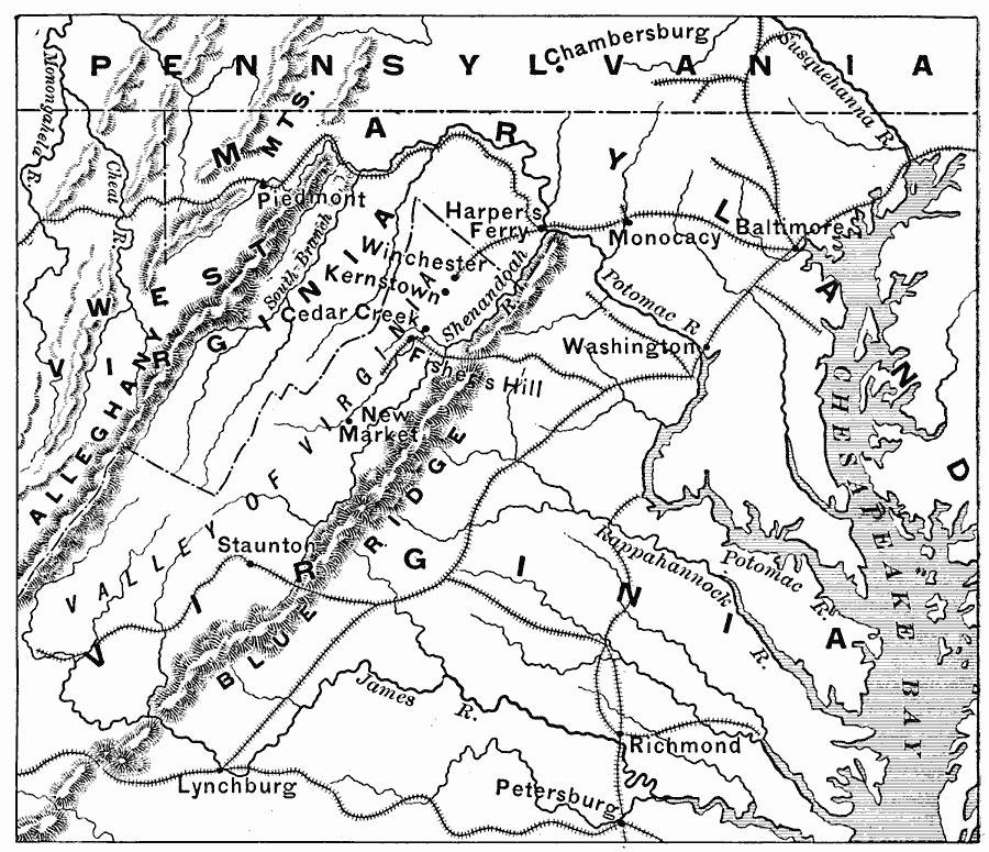
Description: A map of the Valley of Virginia (Shenandoah), showing the site of Lynchburg on the eastern side of the Blue Ridge mountains, and the area of Confederate General Early's march down the Shenandoah to Harpers Ferry in 1864 in his attempt to take Washington.
Place Names: Civil War, Baltimore, �Cedar Creek, �Piedmont, �Kernstown, �Winchester, �Richmond, �Washington D.C
ISO Topic Categories: inlandWaters,
location,
oceans,
boundaries,
intelligenceMilitary
Keywords: Valley of Virginia, transportation, �historical, �physical, �political, physical features, major political subdivisions, railroads, Civil War, inlandWaters,
location,
oceans,
boundaries,
intelligenceMilitary, Unknown, 1864
Source: Edward Eggleston, The Household History of the United States and Its People (New York, NY: D. Appleton and Company, 1898) 338
Map Credit: Courtesy the private collection of Roy Winkelman |
|