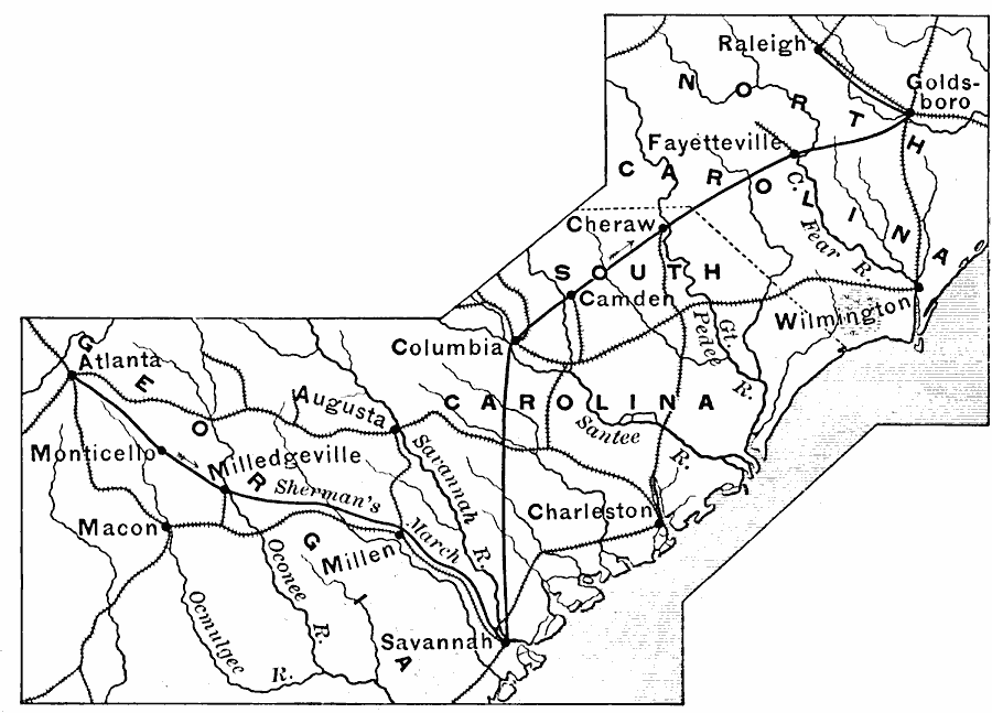
Description: A map of the parts of Georgia, South Carolina, and North Carolina showing the area of Sherman's campaign in late 1864 to early 1865. The map shows the route of Sherman's March from Atlanta to Savannah, and his northward route from Savannah to Raleigh. The map shows state boundaries, railroads, rivers, and major cities and towns, including Macon, Milledgeville, Millen, Augusta, Charleston, Columbia, Cheraw, Wilmington, Fayetteville, and Goldsboro.
Place Names: Civil War, Macon, �Savannah, �Raleigh, �Fayetteville, �Charleston, �Atlant
ISO Topic Categories: boundaries,
inlandWaters,
location,
oceans,
intelligenceMilitary
Keywords: Campaign in the East, physical, �historical, �transportation, �political, physical features, major political subdivisions, railroads, Civil War, boundaries,
inlandWaters,
location,
oceans,
intelligenceMilitary, Unknown, 1864–1865
Source: Edward Eggleston, The Household History of the United States and Its People (New York, NY: D. Appleton and Company, 1898) 344
Map Credit: Courtesy the private collection of Roy Winkelman |
|