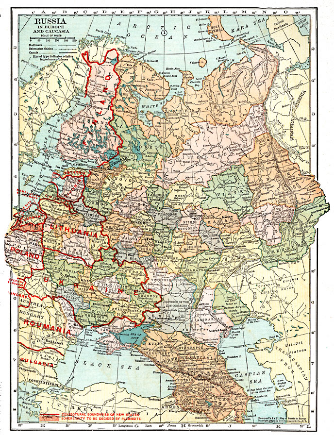
Description: A map of European Russia and the Caucasia at the end of World War I, showing province boundaries at the time, and the conjectural boundaries of the new states at the time the map was made given in red outline. These new states include Finland, Estonia, Livonia, Courland, Lithuania, Poland, Ukraine, portions of Czecho–Slovakia, Hungary, Roumania, and Bulgaria. The map also shows the Free City of Danzig (Gdansk), the territory of Memel ceded by Germany after the war, and the portion of Prussia whose sovereignty was yet to be decided by plebiscite shaded in red. The map shows major cities, ports, railroads, canals, submarine cables, terrain features, lakes, rivers, and large bodies of water in the region.
Place Names: Russia, Finland, �Lithuania, �Ukraine, �Roumania, �Bulgaria, �Poland, �Russia, �Moscow, �Petrograd, �Kasan, �Tiflis, �Baku, �Bukharest, �Warsaw, �Riga, �Stockhol
ISO Topic Categories: boundaries,
inlandWaters,
location,
oceans,
transportation,
utilitiesCommunication
Keywords: Russia in Europe and Caucasia, physical, �political, �transportation, �post world war one, post wwi, physical features, country borders,
major political subdivisions, railroads,
water routes, boundaries,
inlandWaters,
location,
oceans,
transportation,
utilitiesCommunication, Unknown, 1920
Source: , Leslie's New World Atlas (New York City, NY: Leslie-Judge Company, 1920) 18
Map Credit: Courtesy the private collection of Roy Winkelman |
|