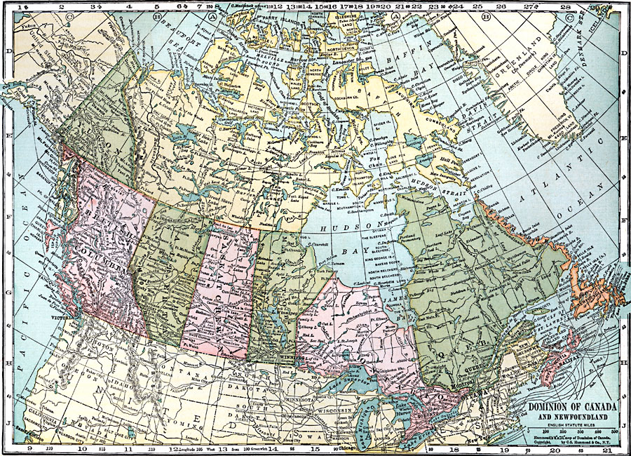
Description: A map from 1920 of the Dominion of Canada and Newfoundland (Newfoundland and Labrador were not part of the Canadian Confederation until 1949), showing the provinces at the time, provincial capitals, major cities, towns, and settlements, railways, submarine telegraph cables, mountain systems, lakes, rivers, coastal features, and islands of the region. Time zones based on noon Greenwich are shown at the top of the map.
Place Names: Canada, Quebec, �Ontario, �Manitoba, �Saskatchewan, �Alberta, �British Columbia, �Yukon, �Labrador, �Nova Scotia, �Halifax, �Newfoundland, �Montreal, �Ottawa, �St. Johns, �Toronto, �Winnipeg, �Vancouver, �Victori
ISO Topic Categories: boundaries,
inlandWaters,
location,
oceans
Keywords: The Dominion of Canada and Newfoundland , physical, �political, physical features, major political subdivisions,
country borders, boundaries,
inlandWaters,
location,
oceans, Unknown, 1920
Source: , Leslie's New World Atlas (New York City, NY: Leslie-Judge Company, 1920) 33
Map Credit: Courtesy the private collection of Roy Winkelman |
|