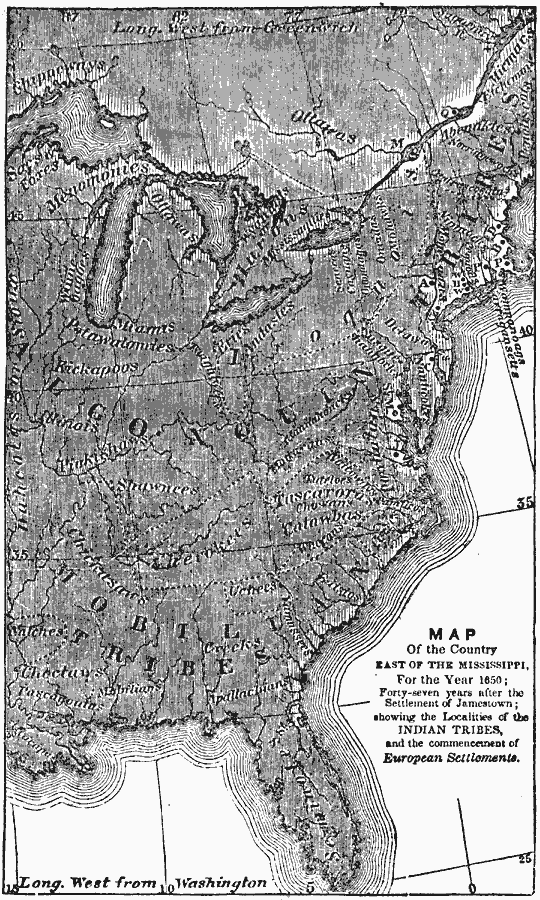
Description: A map from 1872 of the country east of the Mississippi for the year 1650, forty-seven years after the settlement of Jamestown. This map shows early commencement of European settlement and the principal Native American tribal lands east of the Mississippi River, including the territories of the Algonquin tribes (Etchemins, Abenakes, Penobscots, Norrigewocks, Androscoggins, Massachusetts, Pawtuckets, Nipmucks, Pokanokets, Narragansetts, Mohegans, Pequods, Manhattans, Wabingas, Minsi, Delawares, Nanticokes, Susquchannocks, Mannahoacks, Monacans, Powhatan Nation, Shawnees, Miamis, Illinois, Kickapoos, Sacs and Foxes, Menomonies, and Potowatomies), the Iroquois tribes (Five Nations, Tuscaroras, Hurons or Wyandots, Mohawks, Oneidas, Onondagas, Senecas, and Cayugas), the Cherokee Nation, and the Mobilian tribes (Creeks, Choctaws, Chickasaws, and Seminoles).
Place Names: Early America 1400-1800, Colonial America, �Native American
ISO Topic Categories: inlandWaters,
location,
oceans
Keywords: The Country East of The Mississippi, physical, kNativeAmerican, physical features, inlandWaters,
location,
oceans, Unknown, 1650
Source: Marcius Willson, History of the United States (New York, NY: Ivison, Blakeman, Taylor, and Co., 1872) 46
Map Credit: Courtesy the private collection of Roy Winkelman |
|