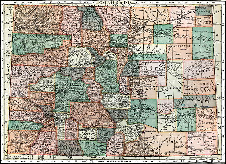
Description: A map from 1920 of Colorado showing the State capital of Denver, counties and county seats, major cities and towns, railroads, the Rockies and other mountain systems, lakes, and rivers.
Place Names: Colorado, Grand Junction, �Montrose, �Delta, �Ouray, �Silverton, �Durango, �Gunnison, �Aspen, �Leadville, �Buenavista, �Del Norte, �Monte Vista, �Alamosa, �Georgetown, �Salida, �Cripple Creek, �Central, �Ft. Collins, �Boulder, �Golden, �Idaho Springs, �Denver, �Ca�Colorado Springs, �Pueblo
ISO Topic Categories: boundaries,
inlandWaters,
location,
transportation
Keywords: Colorado, physical, �political, �transportation, physical features, major political subdivisions,
county borders, roads,
railroads, boundaries,
inlandWaters,
location,
transportation, Unknown, 1920
Source: , Leslie's New World Atlas (New York City, NY: Leslie-Judge Company, 1920) 83
Map Credit: Courtesy the private collection of Roy Winkelman |
|