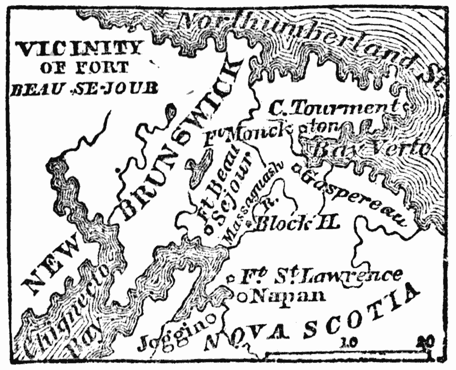
Description: A map of New Brunswick and Nova Scotia near Bay Verte (Green Bay) and the eastern shore of Chignecto showing the campaign of Colonel Monckton in 1775 against the French. "About the last of May, Colonel Monckton sailed from Boston, with three thousand troops, against the French settlements at the head of the Bay of Fundy, which were considered encroachments upon the English province of Nova Scotia. Landing at Fort Lawrence on the eastern shore of Chignecto, a branch of the Bay of Fundy, a French block–house was carried by assault, and Fort Beausejour surrendered, after an investment of four days. The name of the fort was then changed to Cumberland. Fort Gaspereau, on Bay Verte, or Green Bay, was next taken; and the forts on the New Brunswick coast were abandoned. In accordance with the views of the governor of Nova Scotia, the plantations of the French settlers were laid waste; and several thousands of the hapless fugitives, ardently attached to their mother country, and refusing to take the oath of allegiance to Great Britain, were driven on board the British shipping, at the point of the bayonet, and dispersed, in poverty, through the English colonies." — Willson, 1872, pp. 178–179.
Place Names: Canada, Napan, �Joggi
ISO Topic Categories: location,
oceans,
inlandWaters
Keywords: Bay Verte, physical, physical features, location,
oceans,
inlandWaters, Unknown, 1775
Source: Marcius Willson, History of the United States (New York, NY: Ivison, Blakeman, Taylor, and Co., 1872) 179
Map Credit: Courtesy the private collection of Roy Winkelman |
|