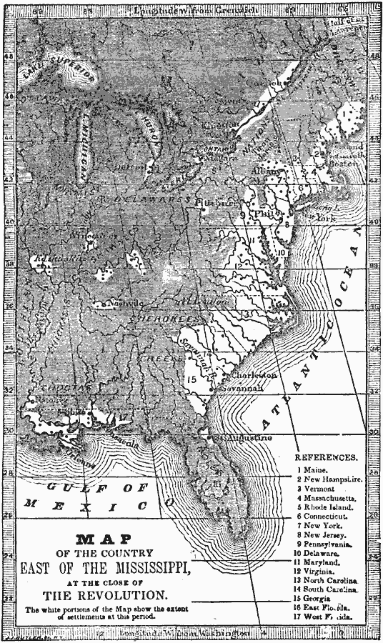
Description: A map from 1872 of the country east of the Mississippi showing the newly formed United States after the ratification of the Constitution in 1789. The map is keyed to show the states at the time and the Spanish territories of West and East Florida. The white portions show the extent of settlement at this period.
Place Names: Early America 1400-1800, Charleston, �Savannah, �Boston, �Albany, �New York, �Philadelphia, �American Revolution, �Colonial Americ
ISO Topic Categories: oceans,
location,
inlandWaters
Keywords: United States at the Close of the Revolution, historical, �physical, �political, physical features, local jurisdictions, American Revolution, oceans,
location,
inlandWaters, Unknown, 1789
Source: Marcius Willson, History of the United States (New York, NY: Ivison, Blakeman, Taylor, and Co., 1872) 284
Map Credit: Courtesy the private collection of Roy Winkelman |
|